Looking for a fun day out? Hit the road and escape the city to one of these must-see day trip destinations in Victoria, all close to Melbourne.
Best road trips in Victoria

Victoria is the perfect location for packing in a diverse range of road trips and scenic drives, from desert landscapes to magical rainforests and spectacular ocean vistas – all easily reached from Melbourne. Here’s seven of the best road trips in the state.
Victoria is arguably the road trip capital of Australia, using its relatively small size to great advantage by offering some of the best scenic drives and geographically diverse landscapes within easy reach of Melbourne.
Here is a guide to seven of the best, and most contrasting, road trips in Victoria, including some that can be comfortably taken in a day or two.
Before you embark on your adventure, ensure that your car is prepared and safe for your road trip, pack an emergency car safety kit, and update your emergency roadside assistance plan. Download the VicEmergency app to your phone to check for official bushfire and extreme weather warnings.
Electric car owners are also advised to check EV charging availability along the route prior to leaving. RACV Members can access information about EV charging stations via the RACV App.
RACV Members save on a range of activities and experiences in Melbourne and Victoria
In this article
Best road trips in Victoria
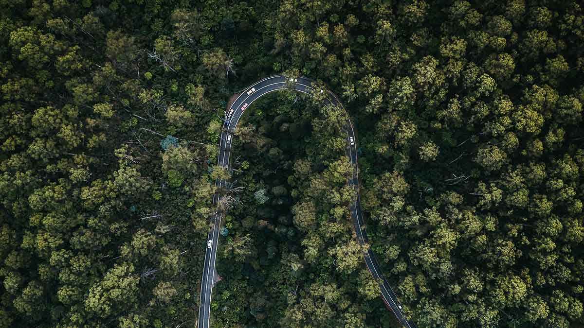
The Black Spur section of the Maroondah Highway, connecting Healesville to the Central Highlands, is a stunning drive. As you weave through the ancient forest and fern gullies, take your time to traverse the winding road and hairpin turns and enjoy the majesty of the area.
The highest-flowering plants on earth, the towering Mountain Ash gum trees are so tightly packed together that the sun barely penetrates through to the forest floor. Stop at Dom Dom Saddle and Fernshaw picnic grounds to admire these giants up close.
Once you’re through the Black Spur, keep going to Marysville, loop back via the Acheron Way to Mount Donna Buang (a sealed but very narrow road) or return to Healesville and then up into Toolangi State Forest. Glory awaits at every turn. Book accommodation in Healesville for the perfect starting and finishing point for the day’s adventure.
Don’t miss: Marysville. It has regrown from the devastation of the 2009 Black Saturday bushfires, and the forest is slowly but surely doing the same.
More: Best free things to do in Victoria’s Yarra Valley
2. Great Ocean Road
• Where: Torquay to Peterborough
• Distance: 200km
• Time to explore: 1-2 days
• Because: It’s a jewel in Victoria’s crown
The popularity of this unique stretch of Victorian coast shows no sign of diminishing; the Great Ocean Road is almost as famous as Uluru and the Great Barrier Reef, but in this case the journey itself is the destination.
On one side, the Southern Ocean is spectacular, no matter what season or time of day. On the other, there are sheer cliffs, but only for as long as it takes to round a promontory and dip into holiday havens such as Lorne and Apollo Bay, or visit the beaches at Wye River, Skenes Creek or Princetown. No trip is complete without seeing the Twelve Apostles and the amazing rock formations and coves near Port Campbell.
Try pulling away from the splendour now and then to explore hidden treasures off the main road. The region has some of the best waterfalls in Victoria, including Beauchamp, Triplet or Hopetoun Falls (all near Beech Forest) or Carisbrook (near Apollo Bay). When the tide is right, walk out to old anchors embedded in the rocks at Wreck Beach, and try any number of great eateries and foodie experiences along the way, including the great variety of cheese at Apostle Whey, near Princetown.
Torquay, with its luxury accommodation and seaside cafes, is an ideal starting and finishing destination for the Great Ocean Road.
Don’t miss: A unique stand of Californian Redwood trees planted near Beech Forest in the 1930s. Their size and colour are remarkable.
More: Where to eat, stay and play in Torquay
3. Great Alpine Road
• Where: Bairnsdale to Wangaratta
• Distance: 310km
• Time to explore: 2-4 days
• Because: It’s Victoria’s highest road
For a good part of the year, most of the traffic on the Great Alpine Road uses only a fraction of it, the goal being the ski resorts of Mount Hotham and Falls Creek. For the rest of the time, it’s the ultimate Victorian road trip that needs several days to appreciate its variety. Leaving the Gippsland Lakes behind, the road north from Bairnsdale is a steady climb, the bubbling Tambo River an almost constant presence on your right.
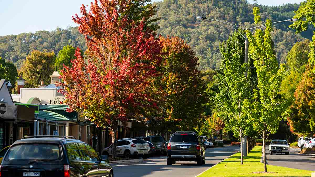
Omeo is a well-preserved gold town, and you’ll find other touchpoints of Victoria’s golden heritage as you approach Mount Hotham, from where the trail to Mount Feathertop is a great walk for the well-prepared hiker. The descent to Ovens Valley is short but steep and winding. If it’s autumn, the foliage colour in Bright is the reward. Don’t ignore the side trip up Mount Buffalo, with its array of wondrous rock formations, trails and panoramic views.
The final stretch flows through classic eucalypt country to Wangaratta. From there, it’s just an hour’s drive to Cobram, a popular holiday destination on the mighty Murray River.
Don’t miss: Milawa, the gourmet capital of the north-east, for its wine, cheese, honey and mustards.
More: The best Australian road trips to tick off your bucket list
4. South Gippsland Highway
• Where: Lang Lang to Wilsons Promontory
• Distance: 140km
• Time to explore: 1 day
• Because: It’s a beautiful route to a spectacular spot
Gippsland delights at every turn, and the road to Wilsons Promontory starts at the prettiest section of the national highway. At first you roll through gentle green hills dotted with dairy cattle. The major towns of Korumburra and Leongatha are easily negotiated, while beautiful villages such as Loch are worth the short detour. The popular seaside town of Inverloch is also nearby, with accommodation, restaurants and attractions, making it an ideal base to tour the region.
If you haven’t brought a picnic lunch, there’s a range of eateries in Koonwarra and Meeniyan as you head east along the South 'Gippy' Highway. Meeniyan is known as ‘the turning point’ and it’s here where you can leave the highway and head south through Fish Creek and Yanakie as the hills gradually give way to low coastal scrub. (The alternative route is to reach Foster, then turn south.)
At every turn around this district, you’re anticipating that first view of the haunting peaks of Wilsons Promontory, the southernmost point of mainland Australia and one of Victoria’s great natural icons.
Don’t miss: Fish Creek for its art and craft outlets and the fabulous art deco Fish Creek Hotel.
More: Things to see, eat and do around Inverloch
5. Calder Highway
• Where: Bendigo to Mildura
• Distance: 400km
• Time to explore: 1-2 days
• Because: It’s full of unforgettable vistas
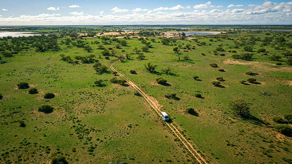
You don’t need to go to central Australia to see the Outback. The Mallee is wide, flat and open, just not as red. Along the Calder Highway you’ll find unique traits in each community.
Inglewood has the intriguing Eucalyptus Distillery Museum, while Wedderburn’s old general store is a step back in time. At 148m above sea level (and just 43m above the surrounding town), Mount Wycheproof is the lowest official mountain in Australia.
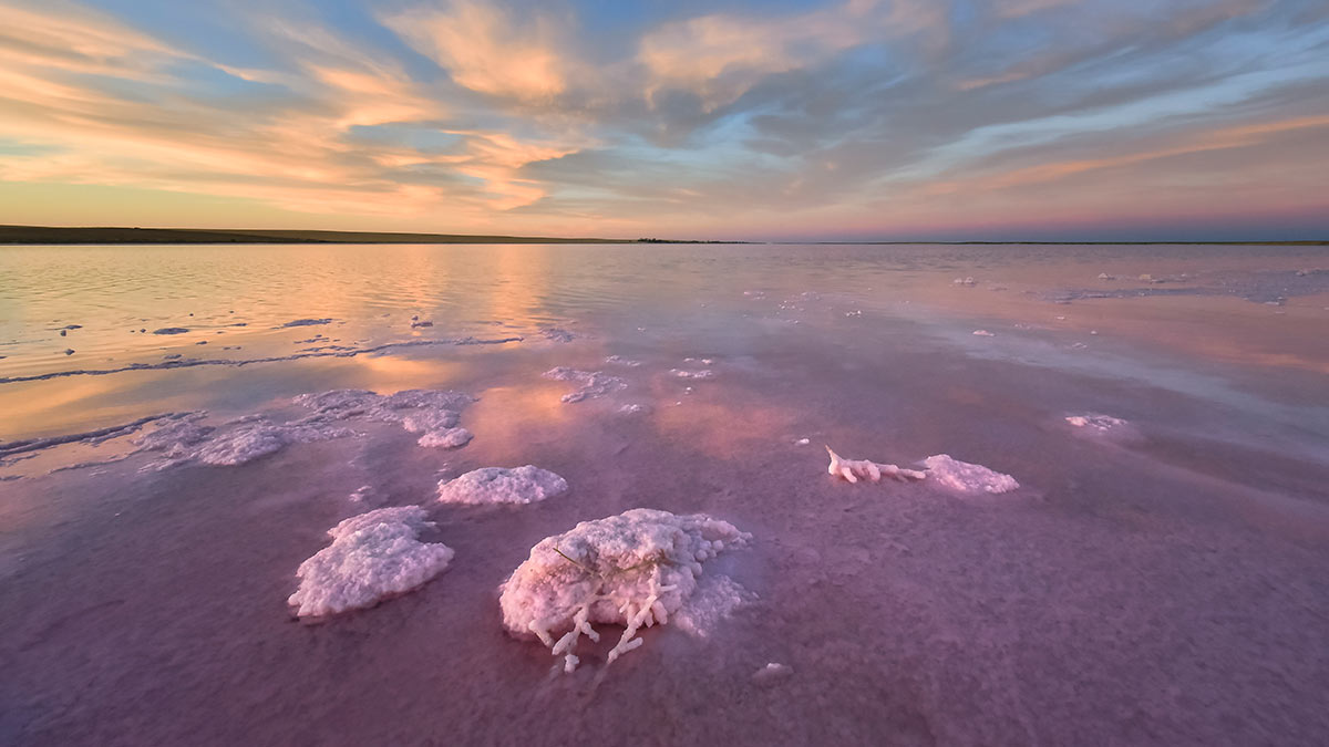
Whether in daylight or when the stars are out, Lake Tyrrell, near Sea Lake, produces mesmerising reflections off its salty surface. In between, count all the grain silos (and go looking for all the huge Silo Art Trail murals) and enjoy the vastness of this fabulous part of Victoria. Creswick, near Ballarat, is well positioned as a springboard into the north-west of the state, with accommodation, family friendly activities, and cycling trails.
Don’t miss: Hattah-Kulkyne National Park between Ouyen and Mildura, one of the most biologically diverse parks in Victoria and a place where Mallee country is writ large.
More: The 7 best stops on a Calder Highway road trip
6. Mornington Peninsula
• Where: Mount Martha to Portsea
• Distance: 40km
• Time to explore: Half/full day
• Because: It’s a beautiful blend of coastline and woodlands
Setting off from Mount Martha, you are greeted by sweeping views of Port Phillip Bay, framed by rugged cliffs and golden sandy beaches. As the road winds its way along the coastline, each twist and turn reveals new perspectives of the natural beauty that characterises this region.
Passing through coastal villages such as Safety Beach and Dromana, you’ll be enticed by inviting cafes, boutique shops and pristine stretches of shoreline, perfect for a leisurely stop to soak in the coastal ambience. Continuing along the scenic route, the landscape transitions to the rugged splendour of the Mornington Peninsula National Park, where towering cliffs and windswept coastal heathlands offer a dramatic backdrop to the journey. If you plan on spending a few days, stay at the southernmost tip of the Mornington Peninsula and explore Cape Schanck.
Arriving in Portsea, the drive culminates in the iconic Portsea Pier, where you can marvel at panoramic views of the coastline and watch as boats bob gently in the harbour.
Don’t miss: Arthurs Seat, where on a clear day the view stretches out as far as the Melbourne city skyline, the You Yangs and Mount Macedon.
More: Best things to eat, see and do on the Mornington Peninsula
7. Dandenong Ranges
• Where: Dandenong Ranges National Park to Silvan Reservoir
• Distance: 20km
• Time to explore: Half/full day
• Because: It’s filled with moments of serenity and awe-inspiring vistas at every turn
Embarking on a scenic drive through the Dandenong Ranges is a journey of discovery, offering a captivating blend of natural beauty, lush forests and charming hilltop villages.
As you wind your way through the meandering roads, you’re surrounded by towering Mountain Ash gum trees, fern gullies and cascading waterfalls. The drive presents an ever-changing landscape, with panoramic vistas of the surrounding valleys and distant city skyline. Along the route, you encounter quaint villages such as Olinda, Sassafras and Emerald, each boasting unique boutiques, art galleries and cafes serving up delicious treats.
A highlight of the journey is the opportunity to explore the enchanting gardens and parks that dot the landscape, including the renowned Dandenong Ranges Botanic Garden (previously known as the National Rhododendron Garden) and the Alfred Nicholas Memorial Gardens. If you’re feeling energetic, the 1000 Steps/Kokoda Track Memorial Walk also beckons.
As you traverse the winding roads, keep an eye out for native wildlife, including colourful parrots, lyrebirds and wallabies. This beautiful short road trip is easily accessible if you're having a staycation in Melbourne’s CBD.
Don’t miss: A ride on Puffing Billy – one of Australia’s oldest and best-preserved heritage steam railways.


